
Driving Theory
British Driving Theory Courses

Lesson 5 of the Signs, Restrictions, Route Planning and Access Limits unit

GB Goods Vehicle Theory: Using Navigation Aids and Real‑Time Updates

This lesson guides you through the responsible use of digital navigation aids while operating a heavy goods vehicle. You will learn how to balance modern routing technology with professional situational awareness to remain compliant and safe on Great Britain's roads.
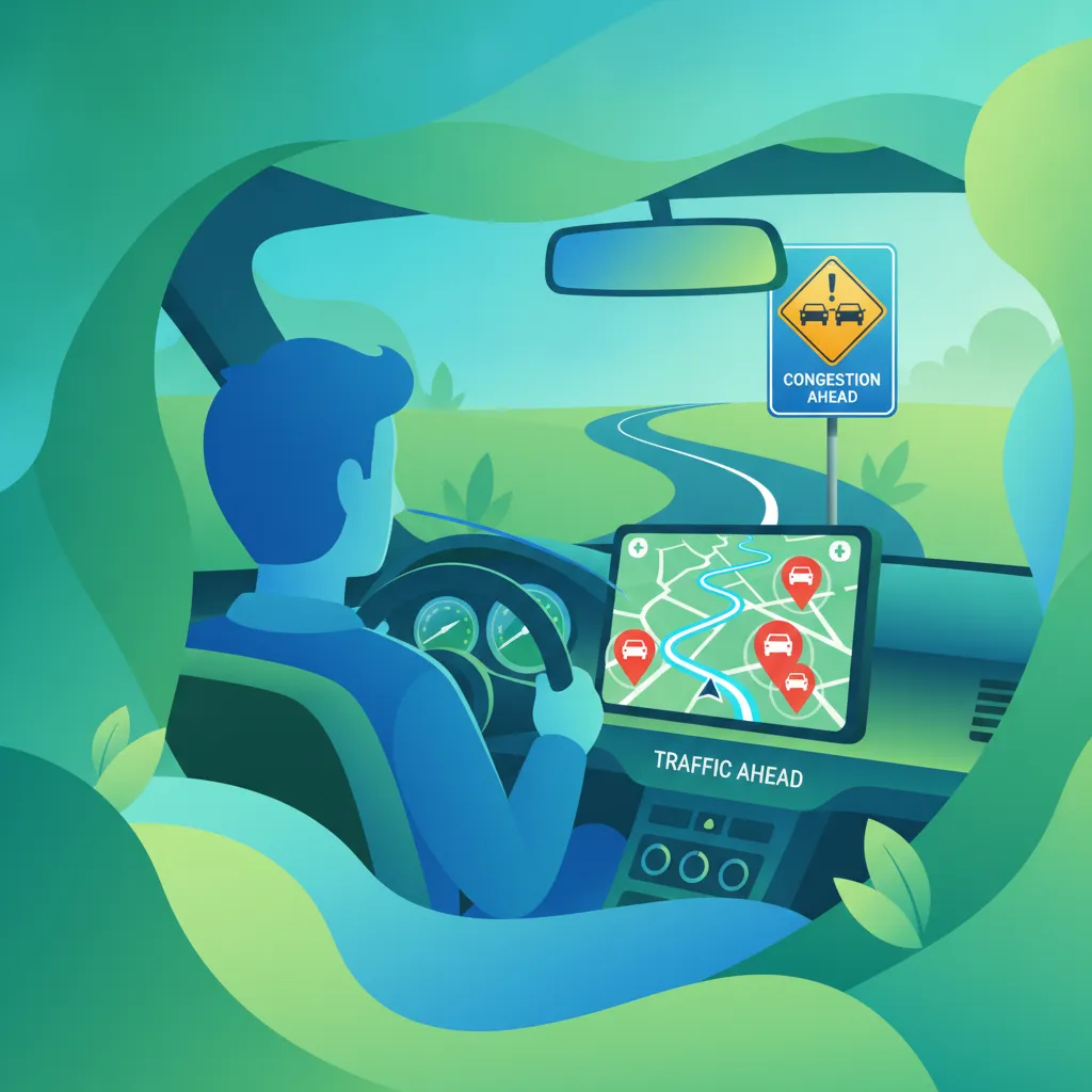
HGV theoryCategory Croute planningnavigation aidsDVSA
GB Goods Vehicle Theory: Using Navigation Aids and Real‑Time Updates

Lesson content overview

GB Goods Vehicle Theory

Navigating Great Britain's Roads: Advanced Aids and Real-Time Updates for Category C Drivers

For professional drivers operating Heavy Goods Vehicles (HGVs) under a Category C Licence in Great Britain, effective navigation extends far beyond simply reaching a destination. It encompasses a sophisticated blend of digital technology and traditional roadcraft, ensuring legal compliance, operational efficiency, and, above all, safety. This lesson, part of your Professional Goods Vehicle Theory for Great Britain - Category C Licence curriculum, delves into the strategic use of modern navigation aids, real-time traffic information, and dynamic routing, while emphasizing the critical need for vigilance and adherence to road regulations.

Operating a large goods vehicle requires precise route planning to account for vehicle dimensions, weight, and specific access restrictions. Modern navigation systems, including GPS devices and HGV-specific mobile applications, offer invaluable support. However, these tools are supplements, not substitutes, for the driver's ultimate responsibility to observe and obey all road signs and legal mandates. Understanding how to integrate these digital aids safely and effectively is crucial for preventing accidents, avoiding legal penalties, and maintaining professional standards.

Tip

Always cross-reference digital navigation with physical road signs. This dual-source verification is a fundamental principle for all professional drivers, especially when operating large goods vehicles with specific dimensional and weight constraints.

Understanding HGV Navigation Systems and Their Role

Modern navigation systems are designed to assist drivers by providing turn-by-turn directions, estimated arrival times, and information about the route ahead. For Category C goods vehicle drivers, these systems often come with specialised features tailored to the unique requirements of HGVs, such as height and weight restrictions, and avoidance of routes unsuitable for large vehicles.

The Evolution of HGV Navigation Tools

Traditionally, HGV drivers relied heavily on large-scale paper maps and their intimate knowledge of routes. While paper maps still serve as a crucial backup, digital navigation has become the primary tool. Modern systems utilise the Global Positioning System (GPS) to pinpoint a vehicle's location, augmented by cellular data for real-time information. Many dedicated HGV navigation devices and apps now incorporate specific databases that include bridge heights, weight limits, and HGV-prohibited roads, aiming to provide routes that are safe and legal for large vehicles.

GPS and Mobile Applications for Goods Vehicles

GPS, or Global Positioning System, is a satellite-based radio navigation system that provides precise positioning. When integrated into dedicated HGV navigation devices or smartphone applications, GPS forms the backbone of digital route guidance. These systems often offer:

  • HGV-Specific Routing: Algorithms designed to consider vehicle height, width, length, and weight, aiming to avoid low bridges, narrow roads, or weight-restricted routes.
  • Points of Interest (POIs): Information on HGV-friendly services, such as truck stops, fuel stations with HGV pumps, and industrial estates.
  • Estimated Time of Arrival (ETA): More accurate predictions factoring in HGV-specific speed limits and potential delays.

However, it's essential to recognise that even the most advanced systems can have limitations, such as outdated map data or an inability to account for temporary restrictions.

Definition

Telematics

Telematics integrates telecommunications and informatics to monitor and manage vehicles remotely. For HGVs, this can include GPS tracking, engine diagnostics, driver behaviour monitoring, and sometimes, integrated navigation.

Key Principles for Safe and Compliant HGV Navigation

Safe navigation for a professional HGV driver is underpinned by several core principles that combine technological assistance with responsible driving practices. These principles ensure that digital aids enhance, rather than compromise, safety and legal compliance.

Dual-Source Verification: Cross-Referencing Road Signs

The principle of Dual-Source Verification dictates that all navigation instructions provided by digital aids must be cross-checked against physical road signs, markings, and official documentation. This is paramount because digital maps can be outdated or fail to capture temporary restrictions.

Warning

Never assume your navigation system is fully up-to-date with all current road conditions. Always verify critical information, such as height clearances, weight limits, and temporary road closures, with visible road signage.

For instance, if a navigation app suggests a route that passes under a bridge, the driver must still look for signposted height restrictions. If the sign shows a clearance lower than the HGV's height, the driver must deviate, regardless of what the system indicates. This practice applies to static signs (e.g., permanent weight limits, no HGV signs) and dynamic signs (e.g., variable message signs, roadwork banners).

Real-Time Traffic Updates and Dynamic Routing

Real-time Traffic Updates provide live data on congestion, incidents, road closures, and variable restrictions. This information is typically sourced via GPS, cellular networks, or integrated vehicle telematics. For HGV drivers, this data is invaluable for avoiding delays, optimising fuel consumption, and adapting to unforeseen circumstances.

  • Congestion Alerts: Warnings about traffic jams or slow-moving traffic ahead.
  • Incident Reports: Notifications of accidents, breakdowns, or roadworks that might affect the route.
  • Variable Message Signs (VMS): Electronic signs that display dynamic speed limits, lane closures, or diversion routes, often linked to real-time traffic conditions.

When real-time data indicates a problem, Dynamic Routing comes into play. This is the automatic or driver-initiated alteration of the pre-planned route. A system might automatically recalculate a new path to bypass congestion, or the driver might manually select an alternative.

However, exercising caution is vital. Any re-routed path suggested by the system must still be assessed for HGV-specific restrictions. A system may suggest an alternate route around a motorway closure, but that alternate route might involve a road with a weight limit or a low bridge unsuitable for your vehicle.

The most fundamental principle is Legal Compliance Priority. This states that national road law, regulations, and physical signage always take precedence over any navigational suggestion. Drivers are legally responsible for obeying all road signs and restrictions, even if a navigation aid fails to warn them or suggests a prohibited manoeuvre.

The Highway Code, particularly rules 168 to 174, provides specific guidance for goods vehicle drivers regarding route restrictions. Ignorance of a sign due to reliance on a navigation system is not a valid defence for a violation. This applies to:

  • Weight Restrictions: Roads or bridges with maximum permissible vehicle weights.
  • Height Clearance: Bridges, tunnels, or overhead structures with height limits.
  • Width Restrictions: Narrow roads or gateways.
  • Access Restrictions: Areas with limitations on vehicle size or type (e.g., residential streets, pedestrian zones, or specific times of day).
  • Low Emission Zones (LEZs) / Clean Air Zones (CAZs): Areas where access is restricted based on vehicle emission standards.

Note

The Road Traffic Regulation Act 1984 underpins many of the legally enforceable restrictions you will encounter. Drivers must always comply with these regulations.

Minimal Distraction: Keeping Focus on the Road

Driver distraction is a significant contributor to road accidents. The principle of Minimal Distraction requires that interaction with navigation devices must not divert the driver's visual, manual, or cognitive attention from the primary task of driving. This is particularly critical for HGV drivers, given the size and stopping distances of their vehicles.

Practical measures to minimise distraction include:

  • Voice-Controlled Interfaces: Using voice commands to input destinations or make route adjustments, keeping hands on the wheel and eyes on the road.
  • Proper Mounting: Positioning the device securely at eye level, where it can be seen with minimal eye movement, without obstructing the view of the road or mirrors.
  • Pre-Journey Setup: Entering destinations and reviewing routes before starting the journey or when safely parked.
  • Audio Cues: Relying on spoken directions rather than constantly looking at the screen.

The Road Safety Act 2006 makes distracted driving illegal. Even a brief glance at a screen can significantly impair reaction time and situational awareness, especially in complex driving situations like roundabouts or busy junctions.

Data Reliability Assessment and System Redundancy

Data Reliability Assessment involves critically evaluating the source, accuracy, latency (how up-to-date it is), and coverage of traffic and navigation data before making decisions based on it. Some data sources are more reliable than others, and coverage can vary between urban and rural areas. A driver should be aware of these limitations.

System Redundancy means having a backup navigation method in case the primary digital system fails. This could be due to:

  • Loss of power or battery depletion.
  • Loss of satellite signal (e.g., in tunnels, deep urban canyons, or remote areas).
  • Loss of cellular network coverage.
  • Software malfunction.

Backup methods might include:

  • Paper maps or an HGV road atlas: Essential for broad overview and when digital systems fail.
  • Offline pre-downloaded maps: Many apps allow downloading maps for areas with poor connectivity.
  • Printed route plans: A detailed printout of the planned route.

Having a robust backup ensures that you can continue your journey safely and legally, even if technology lets you down.

Practical Scenarios and Advanced Considerations

Applying these principles in real-world HGV operations can be complex. Understanding how they interact in various situations is vital for safe and efficient driving.

Managing Low Emission Zones (LEZs) and Clean Air Zones (CAZs)

Many urban areas in Great Britain operate Low Emission Zones (LEZs) or Clean Air Zones (CAZs) to improve air quality. HGVs that do not meet specific Euro emission standards may be subject to charges or outright bans in these zones. Your navigation system can help identify and route around these zones.

Tip

When approaching an LEZ/CAZ, always verify the current requirements and boundary signage. The rules can change, and navigation databases may not always be instantly updated. Check official government websites for the latest information.

Scenario Example: Your navigation warns of an upcoming LEZ. You must verify if your vehicle meets the required emissions standard or if the zone applies to your vehicle type and time of entry. If not compliant, you must follow the system's re-routing suggestion and double-check physical signage for an approved alternative route. Entering an LEZ/CAZ with a non-compliant HGV, even if directed by navigation, will result in significant penalty charges.

Collisions with low bridges or entry onto weight-restricted roads are serious incidents that can cause significant damage, delays, and legal repercussions.

Scenario Example: Your HGV has a height of 4.3 metres. Your navigation system correctly routes you, but due to temporary roadworks, a diversion sign directs you towards a road with a bridge marked with a 4.1-metre clearance. Your navigation system, focused on the original route, may not immediately update to the diversion's restriction. In this situation, Dual-Source Verification is paramount. You must ignore the general navigation instruction for the diversion and observe the physical height restriction sign, then seek an alternative HGV-appropriate route.

Adverse Weather Conditions and System Reliability

Weather conditions significantly impact visibility and road surface. In heavy rain, fog, or snow, road signs may be obscured or difficult to read. In such conditions, audio cues from your navigation system become more critical, but your reliance on visual verification must be heightened where possible.

Warning

Heavy weather can also affect GPS signal strength or cellular network reliability, potentially leading to intermittent navigation performance. Always be prepared to use your backup system.

Conditional Logic: Road Types and Vehicle State

  • Motorways: While motorways generally have fewer static HGV restrictions, they frequently use Variable Message Signs (VMS) to indicate dynamic speed limits or lane closures due to incidents. Navigation systems should ideally integrate with these, but drivers must always obey the VMS.
  • Urban Streets: These are rife with temporary restrictions, loading bay regulations, width limits, and increased interactions with vulnerable road users. Navigation needs to be precise, and drivers must maintain heightened awareness, using voice commands to avoid distraction.
  • Heavily Loaded Vehicle: A fully loaded HGV requires greater braking distances and has different handling characteristics on gradients. Navigation alerts about steep descents or sharp bends become critical safety information, allowing the driver to adjust speed and gear selection proactively.

Rules and Regulations Governing Navigation Aid Use

The legal framework in Great Britain explicitly covers a driver's responsibility when using navigation aids:

  1. Mandatory Compliance with Road Signs: Drivers of Category C Goods Vehicles must obey all road signs, markings, and legal restrictions, irrespective of navigation aid directions. This is enshrined in the Road Traffic Act 1988 and reinforced by the Highway Code (e.g., Rules 168-174 for HGVs). Failure to comply can result in fines, penalty points, or even more severe penalties for dangerous driving.

  2. Prohibition of Distracted Driving: The use of navigation devices must not cause driver distraction that compromises safe vehicle operation. This is illegal under the Road Safety Act 2006. Any activity that diverts visual, manual, or cognitive attention from driving is considered an offence. This means no manual inputting of destinations or extensive screen interaction while the vehicle is in motion.

  3. Verification of Real-Time Data: While real-time traffic data is useful, it must be cross-checked with physical road signs and markings before being acted upon. The driver remains responsible for obeying posted speed limits, temporary diversions, or lane closures, even if the navigation system provides conflicting information or misses a temporary sign.

  4. HGV-Specific Restrictions: Drivers must not rely solely on navigation systems to assess vehicle-specific restrictions (weight, height, width, LEZ compliance) and must manually verify these with on-site signage and their vehicle's specifications. The ultimate responsibility lies with the driver to ensure their vehicle can legally and safely use a given route.

Common Pitfalls and How to Avoid Them

Even experienced drivers can fall prey to common issues related to navigation aid use. Awareness is the first step to prevention.

  1. Blind Faith in GPS: Assuming the system is always correct, leading to ignoring physical "No HGV" signs or low bridge warnings.
    • Solution: Practice Dual-Source Verification rigorously. Always observe and obey physical signs.
  2. Outdated Maps: Relying on navigation with old map data, potentially leading to entry into newly implemented LEZs or onto roads with changed restrictions.
    • Solution: Regularly update your navigation software and map databases. Verify critical restrictions with official local authority websites before travel.
  3. Distracted Driving: Interacting with the screen while driving, especially in complex traffic situations.
    • Solution: Set up your route before moving. Use voice control. If you need to make adjustments, pull over safely.
  4. Lack of Redundancy: Having no backup plan if the primary navigation system fails, leading to getting lost or making unsafe stops.
    • Solution: Carry a current HGV-specific road atlas and/or ensure your digital device has offline map capabilities for your planned route.
  5. Misinterpreting Dynamic Reroutes: Accepting a system-generated detour without verifying its suitability for an HGV (e.g., a shortcut through a residential area with narrow roads or weight limits).
    • Solution: Quickly assess the suggested alternative on the map for obvious HGV incompatibilities. If in doubt, stick to known HGV-friendly routes or larger roads until verification is possible.
  6. Failure to Communicate: Making significant route changes due to navigation suggestions without informing the fleet manager or dispatcher.
    • Solution: Maintain communication with your operations team, especially for critical diversions or potential delays.

Final Concept Summary for Professional Goods Vehicle Drivers

Effective use of navigation aids is an indispensable skill for Category C drivers. It enables efficient route planning, timely deliveries, and proactive response to changing road conditions. However, the technology must be employed within a framework of safety, legal compliance, and constant situational awareness.

The fundamental principle is that navigation aids are sophisticated tools to assist you, not to dictate your driving or override your legal obligations. Your professional responsibility always requires you to be observant, critically assess information, and make informed decisions that prioritise safety and adherence to all road regulations.

Operational Workflow for Navigation Aid Use

  1. Pre-journey Preparation: Plan your route thoroughly, incorporating HGV dimensions and weight. Use HGV-specific route planners. Verify the data source reliability and ensure map updates are recent.

  2. En-Route Monitoring: Actively monitor real-time traffic alerts. Keep your eyes on the road and use audio cues. Only glance at the screen for necessary confirmation.

  3. Decision Point Verification: Whenever the navigation suggests a significant change (e.g., a detour, a change in speed limit interpretation), perform Dual-Source Verification. Check physical road signs and markings before acting.

  4. Distraction Management: Utilise voice controls or pull over safely to interact with the device. Ensure the device is mounted securely and does not obstruct your view.

  5. Redundancy Readiness: Always have a backup navigation method (e.g., offline maps, paper atlas) readily accessible and be proficient in using it.

  6. Communicate Changes: Inform your fleet manager about any significant route alterations or delays caused by traffic or necessary diversions.

By embracing these practices, professional goods vehicle drivers can leverage the power of modern navigation technology to enhance their driving efficiency, ensure legal compliance, and contribute to safer roads for everyone in Great Britain.

Learn more with these articles

Check out these practice sets

Lesson recap

Quick summary before you move on

Fast revision

This lesson teaches Category C HGV drivers how to integrate modern navigation aids—GPS systems, HGV-specific apps, and real-time traffic data—into safe and legally compliant driving practice. The core teaching is the principle of Dual-Source Verification: every navigation instruction must be confirmed against physical road signs and markings, because digital maps can be outdated or miss temporary restrictions. The lesson establishes that Legal Compliance Priority means road law and physical signage always override any navigation suggestion, making the driver legally responsible for obeying all restrictions regardless of device guidance. It covers practical measures to minimise distraction through voice control, proper mounting, and pre-journey setup, as well as the requirement for system redundancy with paper or offline backup maps. Specific attention is given to HGV-relevant scenarios including Low Emission Zones, height and weight restrictions, and dynamic routing around congestion, all grounded in the relevant UK legislation including the Road Traffic Act 1988, Road Safety Act 2006, and Highway Code Rules 168-174.


Core takeaways

Main ideas from this lesson

A short set of high-value points that capture the most important learning from this lesson.

Navigation aids are decision-support tools, not substitutes for driver judgment or legal obligations

Dual-Source Verification—always cross-check digital navigation against physical road signs before acting

Road law, regulations, and physical signage always take legal precedence over any navigation suggestion

HGV-specific routing must account for vehicle height, weight, width, and emission standards

Real-time updates can suggest reroutes, but drivers must verify each alternative for HGV suitability before accepting it

Remember this

Details worth keeping in mind

Point 1

HGV-specific GPS settings are required; standard car navigation ignores vehicle dimensions and weight restrictions

Point 2

Legal responsibility for obeying all road signs rests entirely with the driver, regardless of what the navigation system indicates

Point 3

Device interaction while driving must use voice control or require a safe stop; manual inputting is illegal under the Road Safety Act 2006

Point 4

System redundancy (paper atlas, offline maps, printed route plans) is essential when digital systems fail

Point 5

Low Emission Zones and Clean Air Zones require verification of your vehicle's Euro emissions standard, as navigation databases may not be instantly updated

Watch for this

Frequent learner mistakes

Blind faith in GPS—following navigation into restricted roads despite visible 'No HGV' or height restriction signs

Relying on outdated map data that misses newly implemented LEZ boundaries or recent weight restrictions

Interacting manually with the navigation screen while driving, especially at complex junctions or in heavy traffic

Accepting a dynamic reroute without assessing whether the suggested shortcut is suitable for an HGV's dimensions and weight

Having no backup navigation method, leaving the driver unable to continue safely if the primary system loses signal or power

Search topics related to Using Navigation Aids and Real‑Time Updates

Explore search topics learners often look for when studying Using Navigation Aids and Real‑Time Updates. These topics reflect common questions about road rules, driving situations, safety guidance, and lesson level theory preparation for learners in Great Britain.

using sat nav for HGV theory testDVSA Category C route planning ruleshow to use GPS safely as a professional lorry driverHGV navigation system restrictions and road signspassing the Category C theory exam navigation questionstips for HGV drivers using real time traffic updates

Related driving theory lessons for Using Navigation Aids and Real‑Time Updates

Browse additional driving theory lessons that cover connected traffic rules, road signs, and common driving situations related to this topic. Improve your understanding of how different rules interact across everyday traffic scenarios.

HGV Navigation Systems: Advanced Rules and Legal Compliance in Great Britain

Explore the advanced legal requirements and best practices for using HGV navigation aids and real-time traffic updates. Understand how to ensure compliance and safety on UK roads, focusing on driver responsibility and avoiding common pitfalls.

HGVnavigation aidslegal complianceUK driving theoryroute planning
Route Planning for Goods Vehicles lesson image

Route Planning for Goods Vehicles

This lesson teaches a structured approach to effective route planning, a critical skill for any professional driver. It covers the use of specialized HGV navigation software and traditional maps to account for vehicle dimensions, weight limits, low bridges, and delivery time constraints. The goal is to create routes that are not only the most efficient in terms of time and fuel but are also safe, legal, and responsive to potential disruptions like roadworks or traffic.

GB Goods Vehicle TheorySigns, Restrictions, Route Planning and Access Limits
View lesson
Driving on Motorways with Goods Vehicles lesson image

Driving on Motorways with Goods Vehicles

This lesson focuses on the specific rules and best practices for driving HGVs on motorways in Great Britain. It covers mandatory speed limits for goods vehicles, lane discipline including restrictions on using the outside lane, and procedures for safely joining and leaving the motorway. The lesson also includes up-to-date information on driving on smart motorways, including understanding the signs and using emergency refuge areas correctly.
GB Goods Vehicle TheoryWeather, Motorways, Rural Roads, Roadworks and Emergency Situations
View lesson
Navigating Roadworks and Temporary Restrictions lesson image

Navigating Roadworks and Temporary Restrictions

This lesson provides guidance on how to safely and compliantly navigate through roadworks, which are a common feature of the road network. It covers the interpretation of temporary signs, strict adherence to reduced speed limits, and how to maneuver through narrow lanes and contraflow systems. The paramount importance of protecting road workers by driving with extra care and attention is a central theme of this lesson.

GB Goods Vehicle TheoryWeather, Motorways, Rural Roads, Roadworks and Emergency Situations
View lesson
Required Documentation and Record‑Keeping lesson image

Required Documentation and Record‑Keeping

This lesson covers the critical legal requirement for accurate record-keeping in the transport industry. It provides detailed instruction on the correct use of both analogue and digital tachographs to record driving time, breaks, and other work. You will also learn about other essential documents that must be carried, such as load manifests and delivery notes, and the importance of keeping these records accurate and available for inspection by enforcement authorities.

GB Goods Vehicle TheoryFatigue, Documentation Awareness, Penalties and Professional Conduct
View lesson
Fatigue Management and Rest Hours lesson image

Fatigue Management and Rest Hours

This lesson addresses the serious danger of driver fatigue, a major cause of incidents involving commercial vehicles. It details the complex EU and GB domestic rules on drivers' hours, including driving limits and required rest periods. Learners will be taught to recognize the physical and mental signs of fatigue and understand the importance of taking quality rest to maintain alertness and ensure their own safety and that of others.
GB Goods Vehicle TheoryFatigue, Documentation Awareness, Penalties and Professional Conduct
View lesson
Route Planning and Wayfinding lesson image

Route Planning and Wayfinding

This lesson focuses on the fundamentals of route planning and wayfinding for passenger vehicle drivers. Learners will examine how to use timetables, journey maps, and GPS navigation to identify stops and maintain schedule adherence. The discussion includes best practices for handling route deviations, detours, and unexpected obstructions while keeping passengers informed. Emphasizing service reliability and accurate passenger information, this lesson equips drivers for efficient and safe route execution.
GB Passenger Vehicle TheorySigns, Bus Rules, Restrictions, Stops and Route Awareness
View lesson
Road Signs Specific to Large Vehicles lesson image

Road Signs Specific to Large Vehicles

This lesson provides a detailed focus on the specific road signs that directly affect drivers of large goods vehicles. You will learn to accurately interpret mandatory signs for weight, height, and width restrictions, as well as signs indicating lane usage and prohibited routes. Understanding these signs is not optional; it is a legal requirement for avoiding fines, preventing accidents, and ensuring the safe passage of your vehicle through the road network.

GB Goods Vehicle TheorySigns, Restrictions, Route Planning and Access Limits
View lesson
Maintaining Safe Following Distances lesson image

Maintaining Safe Following Distances

This lesson reinforces the vital safety rule of maintaining an adequate following distance from the vehicle ahead. It explains why the standard 'two-second rule' must be extended for heavy vehicles, especially in poor weather or when heavily laden, to account for longer stopping distances. You will learn practical methods for judging a safe gap in various traffic situations, creating a crucial safety buffer to react to unforeseen hazards.
GB Goods Vehicle TheorySpeed, Braking, Following Distance, Gradients and Heavy Vehicle Control
View lesson
Rural Road Challenges and Speed Limits lesson image

Rural Road Challenges and Speed Limits

This lesson addresses the unique set of challenges that rural roads present to HGV drivers. It covers how to safely navigate narrow and winding lanes, the importance of anticipating hazards like slow-moving agricultural machinery, mud on the road, and wildlife. You will learn how the national speed limit applies to your vehicle on these roads and why it is often necessary to travel at a much lower speed to ensure safety.

GB Goods Vehicle TheoryWeather, Motorways, Rural Roads, Roadworks and Emergency Situations
View lesson
Road Space Occupancy and Maneuvering Clearance lesson image

Road Space Occupancy and Maneuvering Clearance

This lesson examines the physical space a goods vehicle occupies on the road and its impact on maneuvering at junctions, roundabouts, and in tight spaces. Learners will understand the concepts of tail swing and off-tracking, and how to calculate the necessary clearance for safe turns. The content emphasizes maintaining safe distances from other road users and infrastructure, which is a key component of professional spatial awareness and accident prevention.

GB Goods Vehicle TheoryVehicle Size, Weight, Dimensions and Road Space
View lesson

Mitigating Risks with HGV Navigation Aids and Real-Time Traffic Data

Learn to identify and mitigate the risks associated with using navigation aids and real-time traffic updates for HGV drivers in Great Britain. Focus on maintaining situational awareness, avoiding distractions, and understanding system limitations.

HGVdriver distractionrisk managementnavigation technologysafeguarding
Fatigue Management and Rest Hours lesson image

Fatigue Management and Rest Hours

This lesson addresses the serious danger of driver fatigue, a major cause of incidents involving commercial vehicles. It details the complex EU and GB domestic rules on drivers' hours, including driving limits and required rest periods. Learners will be taught to recognize the physical and mental signs of fatigue and understand the importance of taking quality rest to maintain alertness and ensure their own safety and that of others.

GB Goods Vehicle TheoryFatigue, Documentation Awareness, Penalties and Professional Conduct
View lesson
Navigating Roadworks and Temporary Restrictions lesson image

Navigating Roadworks and Temporary Restrictions

This lesson provides guidance on how to safely and compliantly navigate through roadworks, which are a common feature of the road network. It covers the interpretation of temporary signs, strict adherence to reduced speed limits, and how to maneuver through narrow lanes and contraflow systems. The paramount importance of protecting road workers by driving with extra care and attention is a central theme of this lesson.

GB Goods Vehicle TheoryWeather, Motorways, Rural Roads, Roadworks and Emergency Situations
View lesson
Rural Road Challenges and Speed Limits lesson image

Rural Road Challenges and Speed Limits

This lesson addresses the unique set of challenges that rural roads present to HGV drivers. It covers how to safely navigate narrow and winding lanes, the importance of anticipating hazards like slow-moving agricultural machinery, mud on the road, and wildlife. You will learn how the national speed limit applies to your vehicle on these roads and why it is often necessary to travel at a much lower speed to ensure safety.

GB Goods Vehicle TheoryWeather, Motorways, Rural Roads, Roadworks and Emergency Situations
View lesson
Route Planning for Goods Vehicles lesson image

Route Planning for Goods Vehicles

This lesson teaches a structured approach to effective route planning, a critical skill for any professional driver. It covers the use of specialized HGV navigation software and traditional maps to account for vehicle dimensions, weight limits, low bridges, and delivery time constraints. The goal is to create routes that are not only the most efficient in terms of time and fuel but are also safe, legal, and responsive to potential disruptions like roadworks or traffic.

GB Goods Vehicle TheorySigns, Restrictions, Route Planning and Access Limits
View lesson
Strategies for Minimising Collision Risks lesson image

Strategies for Minimising Collision Risks

This lesson synthesizes safety concepts into a proactive strategy for collision avoidance. It teaches the principles of defensive driving, which involves anticipating potential hazards created by other road users or road conditions and planning an escape route. Maintaining high levels of situational awareness, managing distractions, and leaving a significant safety margin around the vehicle are presented as fundamental techniques for minimizing risk on every journey.

GB Goods Vehicle TheoryBlind Spots, Vulnerable Road Users and Urban Delivery Risks
View lesson
Managing Fatigue and Driver Health lesson image

Managing Fatigue and Driver Health

This lesson addresses the serious safety risk of driver fatigue. It explains the warning signs of tiredness and provides strategies for managing it through proper rest and lifestyle choices. The content details the legal requirements under the drivers' hours and working time directive regulations, including the correct use of the tachograph to record rest periods. Maintaining good health, diet, and sleep hygiene is emphasized as fundamental to ensuring a driver is always fit to be on the road.

GB Passenger Vehicle TheoryEmergencies, Evacuation, Fatigue, Penalties and Safe Passenger Service
View lesson
Identifying and Managing Blind Spots lesson image

Identifying and Managing Blind Spots

This lesson provides a detailed map of the significant blind spots located to the front, sides, and rear of a typical heavy goods vehicle. It explains the purpose of the different classes of mirrors and how to adjust them correctly for maximum visibility. Learners will be taught effective scanning techniques—'mirror-signal-manoeuvre'—to actively check these zones before changing position, ensuring they are aware of any hidden hazards or other road users.

GB Goods Vehicle TheoryBlind Spots, Vulnerable Road Users and Urban Delivery Risks
View lesson
Driving on Motorways with Goods Vehicles lesson image

Driving on Motorways with Goods Vehicles

This lesson focuses on the specific rules and best practices for driving HGVs on motorways in Great Britain. It covers mandatory speed limits for goods vehicles, lane discipline including restrictions on using the outside lane, and procedures for safely joining and leaving the motorway. The lesson also includes up-to-date information on driving on smart motorways, including understanding the signs and using emergency refuge areas correctly.
GB Goods Vehicle TheoryWeather, Motorways, Rural Roads, Roadworks and Emergency Situations
View lesson
Speed Management for Heavy Vehicles lesson image

Speed Management for Heavy Vehicles

This lesson focuses on the principles of effective speed management for heavy goods vehicles, which extends beyond simply obeying the statutory speed limits. It covers how to adapt speed based on vehicle weight, load stability, road gradients, and prevailing traffic and weather conditions. You will also learn about the function of mandatory speed limiters and how intelligent use of speed and cruise control can significantly improve fuel efficiency and safety.

GB Goods Vehicle TheorySpeed, Braking, Following Distance, Gradients and Heavy Vehicle Control
View lesson
Risks to Motorcyclists and Scooters lesson image

Risks to Motorcyclists and Scooters

This lesson focuses on the unique risks faced by motorcyclists and scooter riders when sharing the road with HGVs. It explains how their small size and rapid acceleration can make them difficult to see, especially when they are filtering through traffic. Drivers will learn the importance of making extra mirror checks—'look twice'—before any maneuver and giving motorcyclists extra space, as they can be more affected by wind buffeting and road surface imperfections.

GB Goods Vehicle TheoryBlind Spots, Vulnerable Road Users and Urban Delivery Risks
View lesson

Frequently asked questions about Using Navigation Aids and Real‑Time Updates

Find clear answers to common questions learners have about Using Navigation Aids and Real‑Time Updates. Learn how the lesson is structured, which driving theory objectives it supports, and how it fits into the overall learning path of units and curriculum progression in Great Britain. These explanations help you understand key concepts, lesson flow, and exam focused study goals.

Can I trust a standard car GPS for my Category C vehicle?

No. Standard GPS devices do not account for HGV dimensions, weights, or bridge heights. You must use a professional HGV-specific navigation tool that allows you to input your vehicle's specific size and weight profile.

Why should I cross-reference my GPS with road signs?

Navigation aids can be outdated or incorrect. Physical road signs provide the legal ground truth for weight limits, height restrictions, and local access rules. Always prioritise the information provided by road signs.

Is using a mobile phone for navigation allowed for HGV drivers?

It is a distraction and illegal if handled while driving. You must ensure your navigation device is securely mounted and programmed before you start your journey, complying with all safety regulations.

How do real-time updates help with HGV operations?

Real-time updates allow you to avoid congestion, roadworks, and areas with access restrictions or low emission charges. This saves time, fuel, and reduces the risk of entering prohibited zones.

Start Your Targeted Practice Question Search Now

Dive into our comprehensive question bank to find exactly what you need for your Great Britain theory test. Use our advanced filters to pinpoint specific subjects or test your knowledge on challenging areas, ensuring you're fully prepared for success.

Search Practice Questions

Continue your British driving theory learning journey

British road signsBritish article topicsGB AM Moped Theory courseSearch British road signsMotorcycle Theory GB courseGB Category B Theory courseBritish driving theory homeBritish road sign categoriesBritish driving theory topicsGB Goods Vehicle Theory courseSearch British theory articlesBritish driving theory coursesBritish driving theory articlesBritish driving theory practiceBritish practice set categoriesGB Passenger Vehicle Theory courseBritish driving licence proceduresSearch British driving theory practiceBritish driving theory terminology A–ZBritish driving theory terms and glossaryGB Road Signs and Traffic Signals unit in GB Category B TheoryHelmet, Visibility and Protective Behaviour unit in GB AM Moped TheoryAM Licence Basics and Small Vehicle Responsibility unit in GB AM Moped TheoryMotorcycle Licence Basics and Rider Responsibility unit in Motorcycle Theory GBVehicle Size, Weight, Dimensions and Road Space unit in GB Goods Vehicle TheoryCategory B Licence Basics and Driver Responsibility unit in GB Category B TheoryProtective Equipment, Visibility and Rider Condition unit in Motorcycle Theory GBGoods Vehicle Licence Scope and Professional Responsibility unit in GB Goods Vehicle TheoryPassenger Safety, Comfort, Accessibility and Driver Conduct unit in GB Passenger Vehicle TheoryRoute Planning for Goods Vehicles lesson in Signs, Restrictions, Route Planning and Access LimitsPassenger Vehicle Licence Scope and Professional Responsibility unit in GB Passenger Vehicle TheoryWeight, Width and Axle Restrictions lesson in Signs, Restrictions, Route Planning and Access LimitsRoad Signs Specific to Large Vehicles lesson in Signs, Restrictions, Route Planning and Access LimitsAccess Restrictions and Low Emission Zones lesson in Signs, Restrictions, Route Planning and Access LimitsUsing Navigation Aids and Real‑Time Updates lesson in Signs, Restrictions, Route Planning and Access Limits